




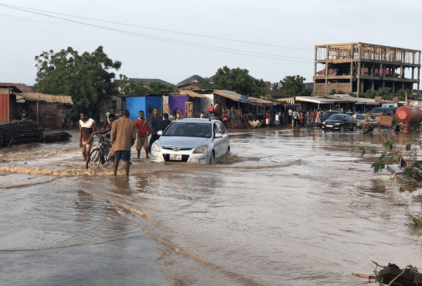
The Ghana Institute of Geoscientists (GhIG) has launched the “Geoscience for a Safer Ghana Initiative” as part of its coordinated effort to address the ongoing crisis. The initiative aims to promote evidence-based strategies for disaster prevention and resilience building across the country in response to the devastating floods and landslides that have ravaged parts of Ghana recently.
The Institute in a statement issued on Monday, July 6, 2026, and signed by Dr. Cyril Dziedzorm Boateng, the General Secretary expressed deep sympathy for those affected by recent natural disasters and emphasizing the importance of immediate and strategic action. Among its urgent recommendations, GhIG called on the government to commission a rapid geohazard mapping exercise in the most severely affected districts. Utilizing existing satellite imagery and remote sensing data, this exercise aims to identify high-risk zones, thereby informing emergency shelter planning and resettlement decisions.
In addition, GhIG urged District Assemblies to suspend issuance of development permits in flood-prone areas and unstable slopes until proper geoscientific assessments are completed—an inexpensive yet crucial step to prevent future tragedies. The institute also recommended that NADMO, Ghana’s disaster management agency, formally include geoscientists in field assessment teams to enhance damage evaluations with geological expertise.
“As part of our efforts, we are committed to shifting Ghana’s flood response from reactionary to evidence-based action,” said Dr. Cyril Dziedzorm Boateng, President of GhIG. “Our long-term goal includes developing a National Geological Hazard and Flood Risk Atlas to better understand and mitigate these perennial disasters.”
The launch of the “Geoscience for a Safer Ghana Initiative” includes several strategic activities throughout July 2026:

– A national media campaign featuring expert articles on how geosciences like hydrology and soil analysis are vital for long-term flood prevention.
– Specialized field assessments of mudslide-affected areas to study ground conditions and landslide tracks, especially in vulnerable hill communities.
– A public technical webinar scheduled for Wednesday, July 29th, at 6:00 PM GMT via Microsoft Teams, aimed at explaining the science behind the crisis and discussing practical solutions.
GhIG emphasizes that understanding the earth’s processes is essential for safeguarding communities and building a more resilient Ghana. The institute invites media outlets, civil society, and government agencies to participate actively in these initiatives and dialogue.